Northeast
Maine fly fishing reports
Use this Maine hub to choose a starting river, check flows and weather, compare hatches, and jump into report pages with access, tactics, regulations, and source links.
Maine quick finder
Open the right report first.
Search Maine reports by river, water type, access style, or flow source. Start with a fishability-ready report when one matches the day.
9
reports
9
fishability-ready
Grand Lake Stream
Grand Lake Stream from the dam and village corridor through the classic walk-in water tied to West Grand Lake
High confidence (90/100)
Kennebec River
The upper Kennebec from Harris Station down toward The Forks, including the lower reach near the Dead River confluence
Good confidence (89/100)
Penobscot River (East Branch)
The East Branch corridor around Grindstone, Oxbow, Lunksoos, and the Katahdin Woods and Waters access reach
Good confidence (89/100)
Reports
9
Region
Northeast
Fishability-ready
9
Planning focus
Flows, hatches, access
Flow coverage
4 with RiverReports chart coverage, 5 without a verified live gauge
BlueStreamFly currently covers 9 Maine fly fishing reports. The list below is organized around real report pages, so the state hub is a fast way to compare watersbefore opening a full river report. Start with the waters that match your trip style, then open the individual page for flow context, weather, hatches, flies, access notes, and source links.
The covered water types include Moosehead Lake to Indian Pond tailwater, Bath, Phippsburg, Richmond, Gardiner, and lower tidal Kennebec water, Below Aziscohos Lake Dam toward the New Hampshire border, Allagash, St. John, Aroostook, Penobscot headwaters, and smaller remote streams, Middle Dam to Umbagog-focused Rapid River water, Grand Lake Stream from the dam and village corridor through the classic walk-in water tied to West Grand Lake, and The upper Kennebec from Harris Station down toward The Forks, including the lower reach near the Dead River confluence. Access styles in the current report set include Dam-influenced wading, rafting, roadside reaches, and private-land awareness, Tidal bank, kayak, skiff, and public-ramp planning, Remote road access, dam-release planning, and private-land sensitivity, Remote logging-road, checkpoint, canoe, and backcountry planning, Remote walk-in, carry-trail, camp, and dam-release planning, Walk-in village and roadside access with classic Maine stream fishing and strict special-law awareness, and Named release-river access, roadside Route 201 scouting, and wade-or-float planning built around flow discipline. That mix matters because a float river, a small trout stream, and a tailwater all need different flow, wading, fly, and safety decisions.
Flow checks are part of the planning path. In this state set,4 with RiverReports chart coverage, 5 without a verified live gauge. When a report uses a RiverReports chart, the page still keeps official gauge or agency sources where available. When only USGS data is available, the report explains the gauge and the practical planning limits.
Maine's covered reports lean toward remote and semi-remote coldwater systems, with tailwater-style outlets, wild brook trout and salmon planning, tidal estuary context, and North Woods logistics.
The state hub should help anglers decide whether they are planning a road-access day, a dam-release trip, a backcountry reach, or a tidal/lower-river option.
Best for
- - Remote brook trout and landlocked salmon planning
- - Dam-influenced outlet water trips
- - North Woods and backcountry access research
- - Anglers comparing freshwater and tidal lower-river opportunities
Check before you go
- - Check Maine regulations, special rules, and seasonal closures before fishing.
- - Confirm road access, gate systems, water releases, and weather before remote trips.
- - Bring a conservative safety plan for backcountry water, cold water, and limited cell service.
- - Use the individual reports to separate tailwater, river, estuary, and remote stream tactics.
Maine pages should keep access and regulation sources close to the copy because remote travel and special rules can decide whether a trip is practical.
Best starting points
First reports to open in Maine
These are not rankings. They are quick starting points from the current inventory, chosen to help you compare water types, access, and source coverage before drilling into the full list.
Moosehead Lake to Indian Pond tailwater
East Outlet Kennebec River
A practical East Outlet report for Moosehead-to-Indian Pond flows, fly-only rules, salmon and brook trout planning, hatches, access, and safety.
Open report
Bath, Phippsburg, Richmond, Gardiner, and lower tidal Kennebec water
Kennebec River Estuary
A tide-first Kennebec Estuary report for striped bass, bait movement, launch logistics, weather, flies, and Maine saltwater regulations.
Open report
Below Aziscohos Lake Dam toward the New Hampshire border
Magalloway River
A source-checked Magalloway River report for Aziscohos release planning, fly-only rules, brook trout, landlocked salmon, hatches, and access.
Open report
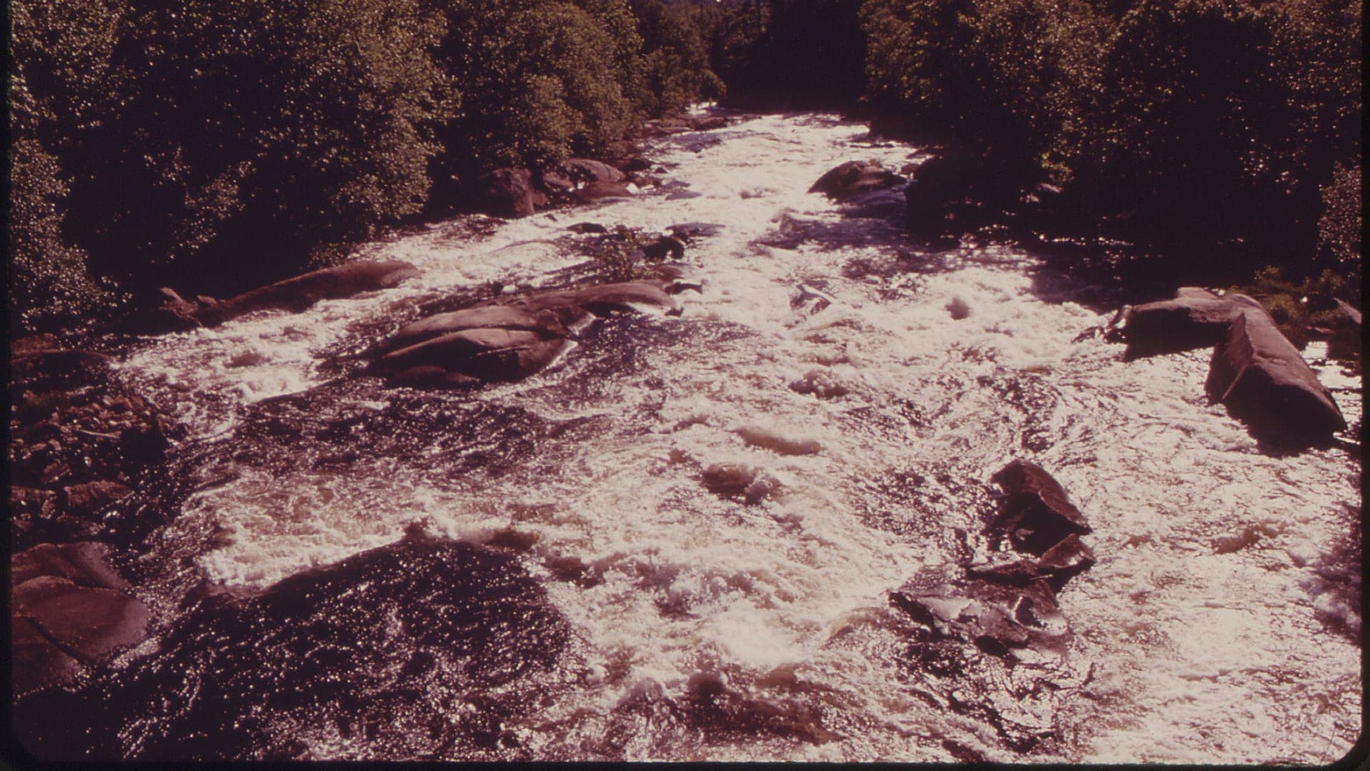
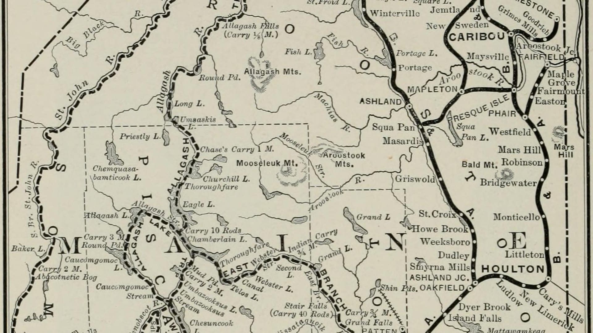
Allagash, St. John, Aroostook, Penobscot headwaters, and smaller remote streams
North Maine Woods Rivers
A regional North Maine Woods report for remote brook trout and salmon planning, road permits, gauges, special laws, access, flies, and safety.
Open report
Middle Dam to Umbagog-focused Rapid River water
Rapid River
A remote Rapid River report for fly-only brook trout and landlocked salmon, Middle Dam access, release checks, hatches, flies, and safety.
Open report
Grand Lake Stream from the dam and village corridor through the classic walk-in water tied to West Grand Lake
Grand Lake Stream
A practical Grand Lake Stream page for anglers planning Maine landlocked salmon and brook trout water around flow, fly-fishing-only rules, village access, and the classic West Grand system.
Open report
Seasons
How to think about timing
The best season changes by elevation, runoff, regulation, water temperature, hatch timing, and access. Use these notes as planning prompts, then confirm the individual river page and current official sources before fishing.
Spring
Cold flows, baitfish movement, early stones, and nymphing can make this a strong subsurface window. See East Outlet Kennebec River.
Early summer
Caddis, mayflies, and stable flows can create the most flexible dry-fly and soft-hackle fishing. See East Outlet Kennebec River.
Late summer
Temperature and release checks become more important than a fixed hatch schedule. See East Outlet Kennebec River.
Fall
Check the exact fall catch-and-release dates and reach rules before planning around salmon and trout movement. See East Outlet Kennebec River.
Late spring
Early striped bass and bait movement can begin when water and migration timing line up. See Kennebec River Estuary.
Hatches
Hatch windows and fly planning
Hatch charts on BlueStreamFly are practical planning notes, not live bug reports. They help you pack flies and choose a starting tactic, then the actual river conditions should make the final decision.
April to May / East Outlet Kennebec River
Midges, early black stones, BWOs, smelt or baitfish movement
Zebra midge, black stonefly nymph, BWO emerger, soft hackle, smelt streamer
Late May to June / East Outlet Kennebec River
Caddis, mayflies, stoneflies, early terrestrials
Elk hair caddis, X-caddis, March Brown, golden stone nymph, pheasant tail
May to June / Kennebec River Estuary
Herring, silversides, sand eels, early crab and shrimp movement
Clouser minnow, deceiver, flatwing, sand eel, small crab
July to August / Kennebec River Estuary
Silversides, peanut bunker, crabs, shrimp, squid at night
Gurgler, crease fly, shrimp, crab, small bunker pattern
Spring / Grand Lake Stream
Midges, caddis, and early mayflies
Soft hackle, bead-head nymph, black ghost, small streamer
Rules, access, and sources
Check the official path before you fish.
Regulations, closures, access, stocking, water temperature, and releases can change faster than a static page. Every river report should be treated as a planning page that points you back to current official sources.
Gauge examples
RiverReports plus USGS 01019000 at Grand Lake Stream, RiverReports plus USGS 01042500 at The Forks, RiverReports plus USGS 01029500 at Grindstone, and RiverReports with USGS 01027200 near Pittston Farm.
Regulations
Maine IFW special fishing laws
Open source page
Regulations
Maine IFW fishing laws and rules
Open source page
Flow
Brookfield SafeWaters Moosehead East and West Outlet
Open source page
Access
Maine IFW Moosehead Region guide
Open source page
Safety and weather
National Weather Service point forecast
Open source page
Regulations
Maine DMR recreational fishing regulations
Open source page
Regulations
Maine DMR striped bass information
Open source page
Flow
NOAA Bath tide station 8417227
Open source page
Full state list
All Maine report pages
Open a specific report for current planning context, nearby water, access notes, regulations, hatches, fly picks, weather, flow checks, and source links.

Maine / Northeast
East Outlet Kennebec River
Check if East Outlet Kennebec River is fishable today with live flow context, weather, access, regulations, hatch timing, flies, and source links.

Maine / Northeast
Kennebec River Estuary
Check if Kennebec River Estuary is fishable today with live flow context, weather, access, regulations, hatch timing, flies, and source links.
Maine / Northeast
Magalloway River
Check if Magalloway River is fishable today with live flow context, weather, access, regulations, hatch timing, flies, and source links.
Maine / Northeast
North Maine Woods Rivers
Check if North Maine Woods Rivers is fishable today with live flow context, weather, access, regulations, hatch timing, flies, and source links.
Maine / Northeast
Rapid River
Check if Rapid River is fishable today with live flow context, weather, access, regulations, hatch timing, flies, and source links.

Maine / Northeast
Grand Lake Stream
Check if Grand Lake Stream is fishable today with live flow context, weather, access, regulations, hatch timing, flies, and source links.

Maine / Northeast
Kennebec River
Check if Kennebec River is fishable today with live flow context, weather, access, regulations, hatch timing, flies, and source links.

Maine / Northeast
Penobscot River (East Branch)
Check if Penobscot River (East Branch) is fishable today with live flow context, weather, access, regulations, hatch timing, flies, and source links.

Maine / Northeast
North Branch Penobscot River
Check if North Branch Penobscot River is fishable today with live flow context, weather, access, regulations, hatch timing, flies, and source links.