Wyoming / West
Bighorn River
A Wyoming Bighorn report for the Thermopolis and Wedding of the Waters corridor, kept separate from the Montana Bighorn tailwater.
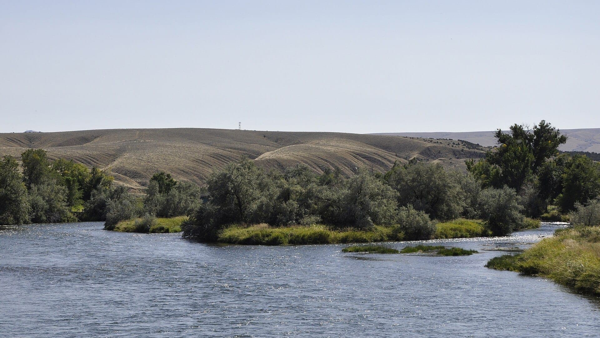
Image: Thermopolis (Wyoming) Bighorn River 13-09-2014 14-58-48 / CC BY-SA 4.0 / Paul HermansFishability now: Bighorn River fishability today
GreatData confidence: High96/100
Fishable now because Kane downstream context gauge is falling, weather is usable, and no public alert is active.
Flow observed
4:15 PM UTC
Weather observed
5:00 PM UTC
Score calculated
5:25 PM UTC
Why this rating
Flow
Weather
Public alerts
Next 6-12 hours
Improving / hold
A falling gauge and usable weather should keep the next 6-12 hours in play unless tributaries stain or heat builds.
USGS flow
1,700 cfs
Current trend: flow falling, rating likely holding strong unless weather or clarity changes.
More planning details: flies, flow bands, and live source checks
Fish it today
Start here
Start at the Wyoming reach you actually plan to fish: Wedding of the Waters for the name change and public access context, Longwell for WGFD access-area planning, or Thermopolis-area banks for a shorter local session. Then choose nymphs, streamers, or dry-dropper work based on water clarity and wind.
Best flow clue
Use USGS 06279500 at Kane as the live downstream flow trend and keep the Thermopolis source for reach context. Stable flow is the best fit; fast rising water, heavy wind, or unclear access boundaries should shorten the plan.
Skip trigger
Skip or reset the plan when Wyoming regulations are unclear, when wind makes casting or boat control poor, when downstream flow is rising hard, when public access boundaries are not obvious, or when the day depends on Montana Bighorn assumptions.
Flow decision bands
Stable Kane trend
Stable downstream Kane flow with manageable Thermopolis weather is the cleanest big-river signal.
Thermopolis reach context
Use Thermopolis and Wedding of the Waters context for the actual reach because the Kane gauge is downstream, not a perfect access-area reading.
Wind or rising water
Strong wind, fast rises, or unclear boat control should shorten the plan before fly choice matters.
Wyoming, not Montana
Do not apply Montana Bighorn tailwater flow, access, or rule assumptions to this page.
USGS flow
1,700 cfs
Current trend: flow falling, rating likely holding strong unless weather or clarity changes.
Live USGS flow
1,700 cfs / falling about 23%
Live NWS forecast
73F / Sunny
Water temperature not verified
Heat guidance uses weather and river type unless an official water-temperature value is available.
No NWS alert flag
No active NWS alert was returned for this forecast point.
Use the Thermopolis source for reach context and the Kane gauge as downstream live flow trend.
Anchor access around WGFD public access areas and confirm each easement boundary.
Nymph and streamer tactics are the safest baseline; dry-fly windows depend on local conditions.
Check Wyoming regulations before keeping trout or using any bait-fishing assumptions.
Editorial review
How this report is maintained
This report is maintained from current regulation, access, flow, weather, and public planning sources so anglers can make better trip decisions than a raw gauge or generic overview would allow.
Byline
BlueStreamFly editorial team
Reviewed by
BlueStreamFly source review
Maintained by
Mountain Brook Run LLC
Last material review
2026-06-01
Report confidence
Good confidence
88/100
Good confidence: Wyoming regulation, WGFD access, USGS Kane trend support, Thermopolis context, weather coverage, NPS background, licensed media, and route-specific Bighorn guidance support the page. Confidence is moderated by downstream gauge context, wind, public-access boundaries, and the need to avoid Montana Bighorn assumptions.
Regulations
Wyoming fishing regulations and 2026 regulation-change sources support current state-specific rule checks.
Access
WGFD Wedding of the Waters and Longwell sources provide strong access anchors, with easement and posted-boundary checks still needed.
Flow and weather
USGS 06279500 at Kane, Thermopolis station context, and the National Weather Service point support live conditions decisions.
Fishing usefulness
The page now separates Wyoming-versus-Montana scope, access-area planning, downstream flow context, wind, pressure, heat, and backup-water choices.
Fishability dashboard and source review
2026-06-01 / material content or source review
Wyoming fishing regulations, 2026 regulation-change information, WGFD Wedding of the Waters and Longwell public-access sources, USGS Thermopolis and Kane references, NPS Bighorn River Kane background, National Weather Service data, and route-specific media-credit sources were checked before updating the current-fishability decision layer.
2026-06-01
Updated Wyoming Bighorn River to the current fishability-page standard with Kane trend bands, Thermopolis access cards, backup cues, stable fishability SEO, and confidence signals.
2026-05-28
Added Wyoming Bighorn trip-fit guidance, Thermopolis access planning, Kane gauge framing, easement nuance, pressure timing, backup-water suggestions, editorial review signals, and a page-specific report-confidence meter after source checks.
2026-05-25
Initial source-reviewed report published with flows, weather, hatches, flies, tactics, access, regulations, and FAQs.
Angler planning edge
Local details that change the plan
Best for
Anglers who want the Wyoming Bighorn near Thermopolis and do not want to confuse it with the Montana Bighorn tailwater, Bank, wade, or short float planning around Wedding of the Waters, Hot Springs County, and WGFD public access areas, Nymph and streamer anglers who can use downstream flow context without pretending it is a perfect reach-specific gauge, Trips where access boundaries, Wyoming regulations, and wind are checked before committing to one bank or launch
Wade or float
Treat this as a large-river bank, targeted-wade, and access-area report. Some boat plans may fit locally, but the public-facing plan should start with WGFD access areas, current flow context, wind, and conservative wading.
Best flows
Use USGS 06279500 at Kane as the live downstream flow trend and keep the Thermopolis source for reach context. Stable flow is the best fit; fast rising water, heavy wind, or unclear access boundaries should shorten the plan.
When to skip
Skip or reset the plan when Wyoming regulations are unclear, when wind makes casting or boat control poor, when downstream flow is rising hard, when public access boundaries are not obvious, or when the day depends on Montana Bighorn assumptions.
Local plan
Start at the Wyoming reach you actually plan to fish: Wedding of the Waters for the name change and public access context, Longwell for WGFD access-area planning, or Thermopolis-area banks for a shorter local session. Then choose nymphs, streamers, or dry-dropper work based on water clarity and wind.
Pressure
Pressure is most visible around named public access areas and easy Thermopolis-area water. A weekday start, willingness to walk within legal access, and a Wind or Shoshone backup make the plan more resilient.
Access nuance
WGFD public-access pages are strong anchors, but easement limits, parking areas, posted land, irrigation infrastructure, and large-river crossings still need attention. Do not assume public access continues beyond the signed area.
Backup water
If the Wyoming Bighorn is windy, rising, crowded, or access-limited, compare the Wind River for upstream context, the Shoshone for a Cody-area tailwater plan, or the Snake River for a different Wyoming trout trip.
About the river
Setting, character, and why it fishes the way it does.
Near Thermopolis, the Wind River leaves the canyon and becomes the Bighorn at Wedding of the Waters. That naming change is the main reason this page must be scoped carefully.
The river here has western tailwater influence, public access areas, private-bank limits, and mixed trout opportunity. It is not the same trip as the famous Montana Bighorn below Yellowtail Dam.
A good day starts with the Thermopolis gauge, then a specific access plan. Do not assume every open-looking bank is public.
Target species
Brown trout
A core trout target around deeper banks, seams, and streamer water.
Rainbow trout
Likely around riffles, soft edges, and productive nymph lanes.
Snake River cutthroat
Possible in WGFD access context; identify trout carefully before harvest.
Mountain whitefish
Common western river fish that can be active on nymphs.
Reading the water
Stable tailwater flow
Nymph seams, buckets, and walking-speed edges before switching to dries.
Slight stain
Use streamers and larger nymphs along banks and soft inside bends.
High or fast
Limit wading, use heavier rigs from safe banks, or choose a calmer access point.
Low and clear
Lengthen leaders, fish smaller nymphs, and avoid repeated casts over visible trout.
Best seasons
Spring
Good nymph and streamer windows when weather and flows are stable.
Summer
Early and late sessions fish best; watch water temperature and afternoon wind.
Fall
Streamer and nymph fishing can improve as temperatures cool.
Winter
Midday nymphing can work when ice, wind, and access allow.
USGS flow
Bighorn River at Kane downstream context
This is the fallback for rivers that are not covered by RiverReports. Use the official USGS monitoring page for the live hydrograph, station metadata, and current water trend.
Open USGS gaugeUSGS data chart
Bighorn River at Kane downstream context
Streamflow over the latest USGS reporting window.
Latest
1,700 cfs
Jun 3, 4 PM UTC
Weather
River weather report
Weather can change wading safety, road access, water temperature, hatches, and the best time of day to fish.
Live forecast loads as you reach this section
This keeps the report fast while still using the official National Weather Service forecast point.
Hatches and flies
Hatch chart and fly picks
March to April
Midges, little black stones, early BWOs, and cold-water nymph windows
Zebra midge, black stonefly, BWO emerger, pheasant tail, small perdigon
May to June
Runoff edges, salmonflies where present, caddis, PMDs, and Green Drakes on some water
Stonefly nymph, Pat's rubber legs, PMD emerger, elk hair caddis, green drake
July to September
Caddis, PMDs, terrestrials, small olives, ants, beetles, and hopper banks
Chubby Chernobyl, hopper, ant, beetle, X-caddis, small parachute Adams
October to February
BWOs, midges, October caddis in places, streamers, and slow winter nymphing
BWO emerger, midge pupa, October caddis pupa, sculpin, black woolly bugger
Dry flies
Chubby Chernobyl, parachute Adams, PMD, BWO, elk hair caddis, ant, beetle, hopper
Use when trout are looking up, when a dry-dropper needs a visible point fly, or when summer banks fish well.
Nymphs
Pat's rubber legs, pheasant tail, perdigon, hare's ear, zebra midge, caddis pupa
Use during cold water, runoff edges, bright afternoons, or when trout are holding in deeper seams.
Streamers
Sculpin, sparkle minnow, olive bugger, black leech, small articulated baitfish
Use around banks, undercuts, structure, and safe stained-water windows.
Tactics
How to fish it
Start with indicator or tight-line nymphing through walking-speed seams.
Use streamers along banks when flows are safe and the water has a little color.
Break large runs into short targets instead of blind-casting the whole river.
Check public-access signs before moving along a bank away from the parking area.
Carry a thermometer in summer and reduce trout handling when water is warm.
Rigging
Rod, leader, and setup notes
A 5 or 6-weight covers nymphs, dry-dropper rigs, and moderate streamers.
Use 3X to 5X tippet for most trout rigs and heavier tippet for streamers.
Bring split shot and larger indicators for deeper tailwater lanes.
Use a wading staff; the river can look calmer than it feels once you step in.
Access
Access and planning notes
Kane gauge
Downstream live trendWade / float / trail
USGS gauge / big-river context
When to pick it
Start here when flow direction and storm response decide whether Thermopolis water is worth checking.
Caution
It is downstream context, so verify the actual access area and wind before wading or floating.
Wedding of the Waters
Name-change and public-access contextWade / float / trail
WGFD access / bank / selective wade
When to pick it
Use this when you need Wyoming-specific Bighorn planning instead of Montana tailwater assumptions.
Caution
Easement limits, parking, and posted edges still need current checks.
Longwell and Thermopolis banks
Short local sessionWade / float / trail
Access area / bank / wade scout
When to pick it
Pick this when legal access, wind, and stable flow line up for nymphs or streamers.
Caution
Large-river crossings, irrigation infrastructure, and private edges can limit movement quickly.
Public access areas can be narrow and site-specific.
This page intentionally avoids Montana Bighorn rules, flows, and access language.
Private property and riverbank rules should be checked before walking beyond signed access.
Regulations
Check before fishing
Check current Wyoming Game and Fish regulations for Area 2 and any Bighorn River exceptions before fishing. Do not apply Montana Bighorn regulations to this page.
Primary base
Thermopolis, Kirby, and Hot Springs State Park
Best day style
Large-river bank, wade, and public-access-area planning
Check first
WGFD Area 2 rules, public-access-area boundaries, USGS Thermopolis flow, weather, and private land
Safety
Cold tailwater, swift channels, slippery rocks, private banks, and hot-spring area crowds
Gear
Helpful gear for this water
4 to 6-weight rod
Covers dries, nymphs, small streamers, and most trout-water wind.
Thermometer
Check water temperature before trout handling in summer or thermal water.
Wading staff
Western rivers and tailwaters have pushy seams, slick rocks, and sudden drop-offs.
Rain shell and layers
Mountain weather can change quickly even when the forecast looks mild.
Nearby water
Other water to research
Backup logic
Wind or rising flow
Shorten to protected banks or compare Wind River, Shoshone River, or Snake River.
Access uncertainty
Stay within signed WGFD access instead of guessing at easements or posted banks.
Heat
Check water temperature, fish early, and avoid extended trout handling if recovery looks weak.
Crowding
Move within confirmed public access or use another Wyoming trout route rather than stacking on one pullout.
Wind River
The upstream name and Dubois-area trout plan before the river becomes the Bighorn.
Shoshone River
A Cody-area tailwater and mainstem alternative with dam-controlled flow.
Snake River
A Jackson Hole cutthroat-focused river with different park and float logistics.
FAQ
Fast answers
Is Bighorn River fishable today?
Bighorn River looks very fishable right now. The live score is 96/100, based on current flow, weather, public alerts, and the report's planning context. Recheck the linked gauge and forecast before leaving because conditions can change quickly after rain, heat, access changes, or flow swings.
What flow is best for Bighorn River?
Use USGS 06279500 at Kane as the live downstream flow trend and keep the Thermopolis source for reach context. Stable flow is the best fit; fast rising water, heavy wind, or unclear access boundaries should shorten the plan.
When should I skip Bighorn River?
Skip or reset the plan when Wyoming regulations are unclear, when wind makes casting or boat control poor, when downstream flow is rising hard, when public access boundaries are not obvious, or when the day depends on Montana Bighorn assumptions.
Is Bighorn River safe to wade right now?
The fishability score is not a wading guarantee. Wade only where your chosen access has safe edges, clear footing, legal entry, and no forced crossings; high, rising, stained, or storm-affected water should be treated conservatively.
What should I check before fishing Bighorn River?
WGFD Area 2 rules, public-access-area boundaries, USGS Thermopolis flow, weather, and private land
Which flow should I use for Bighorn River?
Use the USGS 06259500 Bighorn River at Thermopolis station page for the exact reach. The embedded official USGS graph uses 06279500 at Kane only as downstream Bighorn context because the Thermopolis graph endpoint was not usable during review.
Where should I start on Bighorn River?
Start with WGFD Wedding of the Waters and Thermopolis-area public access areas, then confirm each posted boundary.
Can I wade Bighorn River?
Yes in some edge water at manageable flows, but the Bighorn is a large river. Treat deep channels and fast seams with caution.
Sources
Source set for this report
Reviewed 2026-06-01