Vermont / Northeast
Winooski River
A Winooski report that separates the Waterbury trophy trout plan from lower-river mixed species water near Lake Champlain.
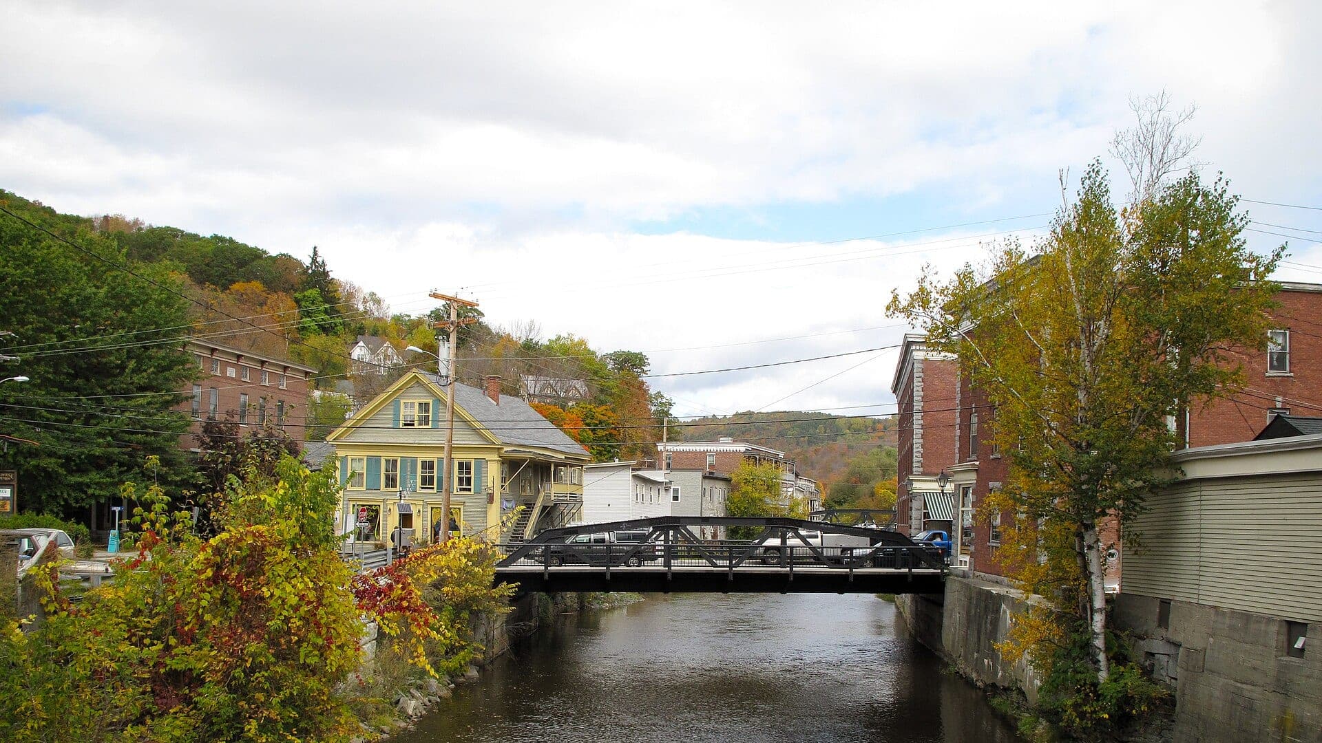
Image: Montpelier VT - Winooski River / CC BY 2.0 / Michael CaloreFishability now: Winooski River fishability today
UnknownData confidence: Medium44/100
Check live sources first because flow has been checked, weather is usable, and no public alert is active.
Flow observed
Not returned
Weather observed
5:00 PM UTC
Score calculated
5:25 PM UTC
Why this rating
Flow
Weather
Public alerts
Next 6-12 hours
Hold
Wait for a better live check before committing the drive or choosing a wading plan.
Flow check
No live chart
Current trend: previous-score comparison will become more useful after repeated live checks.
More planning details: flies, flow bands, and live source checks
Fish it today
Start here
Pick the reach first: Waterbury for trout with current rule checks, Richmond and lower valley for broader river context, or Colchester/lower river only when access, species, and boundary rules are clear.
Best flow clue
Use USGS 04288040 near Waterbury and USGS 04290500 near Essex Junction as context, then match the reading to the actual reach. The page does not use a RiverReports chart, so local rain, temperature, and visual clarity still matter.
Skip trigger
Skip or change the plan when the target reach is rising, dam or storm influence makes wading unsafe, trout water is too warm, lower-river access is unclear, or Lake Champlain boundary context does not match your species plan.
Flow decision bands
Pick the reach first
Waterbury trout water, Richmond valley water, and lower Winooski mixed-species water need different decisions.
Best trout window
Stable Waterbury context, cool water, and current reach rules support a careful trout plan.
Storm, dam, or lower-river push
Rising water, dam influence, storm stain, or unsafe lower-river current should move the plan elsewhere.
Warm or species-shifted
When trout water is warm, the better call may be a lower-river warmwater target or a colder backup.
Flow check
No live chart
Current trend: previous-score comparison will become more useful after repeated live checks.
No structured live flow
Use the linked flow and access sources before deciding.
Live NWS forecast
78F / Sunny
Water temperature not verified
Heat guidance uses weather and river type unless an official water-temperature value is available.
No NWS alert flag
No active NWS alert was returned for this forecast point.
Check Waterbury trophy trout reach rules before fishing that corridor.
Do not use lower-river conditions as proof the trophy reach is safe or cool.
Lower Winooski access can shift into bass, pike, perch, and Lake Champlain context.
Summer trout fishing should be temperature-driven and conservative.
Editorial review
How this report is maintained
This report is maintained from current regulation, access, flow, weather, and public planning sources so anglers can make better trip decisions than a raw gauge or generic overview would allow.
Byline
BlueStreamFly editorial team
Reviewed by
BlueStreamFly source review
Maintained by
Mountain Brook Run LLC
Last material review
2026-06-01
Report confidence
Good confidence
86/100
Good confidence: Vermont regulation, access, river-index, Colchester Point, USGS station context, weather coverage, media credit, and route-specific reach-selection guidance support the page. Confidence is moderated by reach-to-reach variation, no RiverReports chart in the page data, lower-river boundary issues, and summer temperature limits.
Regulations
Vermont regulation, year-round trout, and river-index sources support reach-specific legal checks.
Access
Colchester Point and state fishing-opportunity sources support planning, but exact reach access and lower-river boundaries still need day-of confirmation.
Flow and weather
USGS Waterbury, USGS Essex Junction, and the National Weather Service point provide useful context, but no RiverReports chart is used for the page.
Fishing usefulness
The page now separates Waterbury trout planning, lower-river mixed species, temperature restraint, access boundaries, no-chart limits, and backup-water choices.
Fishability dashboard and source review
2026-06-01 / material content or source review
Vermont Fish and Wildlife regulation, fishing-opportunity, year-round trout, river-index, Colchester Point access, USGS Waterbury and Essex Junction station context, National Weather Service data, and media-credit sources were checked before updating the current-fishability decision layer.
2026-06-01
Updated Winooski River to the current fishability-page standard with no-RiverReports-chart flow context, reach-selection access cards, backup cues, stable fishability SEO, and confidence signals.
2026-05-29
Added Winooski River trip-fit guidance, Waterbury and Essex Junction gauge context, reach-selection planning, lower-river access nuance, trout and warmwater pivots, backup-water suggestions, editorial review signals, and a page-specific report-confidence meter after source review.
2026-05-24
Initial source-reviewed report published with flows, weather, hatches, flies, tactics, access, regulations, and FAQs.
Angler planning edge
Local details that change the plan
Best for
Vermont anglers deciding between Waterbury trout water and lower Winooski mixed-species or Lake Champlain-influenced water, Trout trips where reach-specific rules, water temperature, and storm history matter before fly choice, Lower-river bass, pike, perch, and warmwater streamer days when trout handling is not the right plan, Anglers who need to compare Winooski conditions with Otter Creek, Black River, or the lower White before driving
Wade or float
Treat the Winooski as a reach-selection report. Waterbury trout water is a careful wade plan; lower river sections may call for bank, canoe, kayak, or warmwater streamer tactics depending on access and flow.
Best flows
Use USGS 04288040 near Waterbury and USGS 04290500 near Essex Junction as context, then match the reading to the actual reach. The page does not use a RiverReports chart, so local rain, temperature, and visual clarity still matter.
When to skip
Skip or change the plan when the target reach is rising, dam or storm influence makes wading unsafe, trout water is too warm, lower-river access is unclear, or Lake Champlain boundary context does not match your species plan.
Local plan
Pick the reach first: Waterbury for trout with current rule checks, Richmond and lower valley for broader river context, or Colchester/lower river only when access, species, and boundary rules are clear.
Pressure
Pressure follows easy access, trophy-trout interest, cool-water windows, and lower-river weekends. A second reach or a different Vermont river keeps the day from hinging on one busy access point.
Access nuance
Official access and regulation sources are useful, but the Winooski changes character quickly. Respect posted banks, local closures, urban safety, and lower-river boundary differences.
Backup water
If the Winooski is high, warm, crowded, or rule-complicated, compare Otter Creek, Black River, or White River Lower before forcing the same reach.
About the river
Setting, character, and why it fishes the way it does.
The Winooski is one of Vermont's major rivers, running from the Green Mountains through central and northwestern Vermont before entering Lake Champlain. That length creates several different fishing personalities.
Around Waterbury, anglers think first about trout rules, cool-water windows, and precise access. Downstream, the river broadens and the lower Winooski adds more mixed species and Lake Champlain boundary considerations.
This page is built to avoid the common mistake of giving one generic Winooski answer. It helps you decide which section you are actually fishing, what to check first, and when conditions argue for a different plan.
Target species
Brown trout
Key trout target in cooler, managed reaches and deeper cover.
Rainbow trout
Possible in trophy or stocked contexts; verify current reach rules.
Brook trout
More relevant in cold tributary and upper-basin context.
Bass, pike, perch, and panfish
Lower-river and Lake Champlain-influenced context, not the trophy trout reach.
Reading the water
Waterbury trout reach
Lead with current Vermont rule language, temperature, and exact access boundaries.
Lower river
Think current seams, bridge shade, warmwater flies, and Lake Champlain boundary checks.
After storms
Expect pushy flows and stained water; wade only after the reach settles.
Warm weather
Use a thermometer and protect trout when water climbs.
Best seasons
Spring
High but improving trout and streamer window after flows settle.
Summer
Early trout windows near cool water; lower-river warmwater options later.
Fall
Cooler flows can improve trout and streamer fishing.
Winter
Use only legal open water and slow, careful nymphing.
Flow
Winooski River Waterbury trout reach
No RiverReports chart is used for this reach-selection page. Use USGS Waterbury and Essex Junction station context with current weather, temperature, and the exact reach before wading.
Official water source
USGS 04288040 Winooski River near Waterbury
Use the official Waterbury station for upper-river context, then compare the lower-river gauge, recent rain, and local access before choosing a reach.
Open official sourceWeather
River weather report
Weather can change wading safety, road access, water temperature, hatches, and the best time of day to fish.
Live forecast loads as you reach this section
This keeps the report fast while still using the official National Weather Service forecast point.
Hatches and flies
Hatch chart and fly picks
April to May
Hendricksons, Quill Gordons, BWOs, early caddis, and high-water nymphing
Hendrickson, BWO emerger, caddis pupa, hare's ear, stonefly nymph
June to July
Caddis, sulphurs, Light Cahills, March Browns, and evening spinners
Sulphur emerger, Light Cahill, elk hair caddis, soft hackle, spinner
August to September
Terrestrials, ants, beetles, tricos, and shaded small-stream attractor fishing
Foam ant, beetle, hopper, trico, small stimulator, perdigon
October to March
BWOs, midges, small stones, and slow winter nymph windows where legal
BWO emerger, zebra midge, stonefly nymph, soft hackle, small bugger
Nymphs
Perdigon, pheasant tail, hare's ear, zebra midge, caddis pupa, stonefly
Use before hatches, in pocket water, or when trout hold close to bottom.
Dries and dry-droppers
Parachute Adams, BWO, caddis, sulphur, ant, beetle, hopper, stimulator
Use during visible rises, searching pocket water, and low clear water.
Streamers
Sculpin, olive bugger, black bugger, leech, small baitfish
Use after rain, in stained water, or along undercut banks and ledges.
Tactics
How to fish it
Read the legal reach first, then rig for the water type you are actually fishing.
Use dry-droppers and small nymphs in trout water when flows are stable and clear.
Fish streamers or larger nymphs along cutbanks when safe color gives trout cover.
Switch to bass and pike streamers in lower-river warmwater context instead of stressing trout.
Use local signs and current Vermont rules around any lower-river closure or boundary.
Rigging
Rod, leader, and setup notes
A 9-foot 5-weight covers trout work; a 6 or 7-weight is better for lower-river streamers.
Carry 4X to 6X for trout and heavier leaders for bass or pike context.
Use dry-droppers in pocket water, indicators in deeper slots, and streamers on safe color.
Carry a thermometer and do not force trout fishing on hot afternoons.
Access
Access and planning notes
Waterbury gauge context
Upper trout referenceWade / float / trail
USGS context / no-chart fallback
When to pick it
Start here when the plan is Waterbury-area trout water.
Caution
This page does not use a RiverReports chart, so pair the station with weather, temperature, and local clarity.
Richmond and lower valley reaches
Reach-selection checkWade / float / trail
Wade / bank / scout
When to pick it
Use this when the day may shift between trout and broader river context.
Caution
Posted banks, local closures, and urban safety still need current checks.
Colchester and lower-river context
Warmwater or boundary-sensitive planWade / float / trail
Bank / canoe / kayak / access
When to pick it
Pick this only when species target, access, and Lake Champlain boundary context are clear.
Caution
Lower-river rules, access, and safety can differ sharply from upper trout water.
Waterbury trout guidance should not be applied blindly to the lower river.
Urban and lower-river banks can involve closures, bridges, and posted property.
Lake Champlain boundary rules and species context matter near the river mouth.
Regulations
Check before fishing
Check Vermont Fish and Wildlife rules, the river index, and lower-river access notices before fishing the Winooski.
Primary base
Waterbury, Richmond, Burlington, or Colchester, Vermont
Best day style
Reach-specific trout rules, lower-river access checks, and urban/valley safety
Check first
Vermont rules, trophy reach boundaries, lower-river closures, rain, temperature, and access
Safety
Dam-influenced water, urban banks, slick rocks, warm summer trout stress, and changing lower-river species
Gear
Helpful gear for this water
Four or five-weight rod
Covers most dries, nymphs, and dry-dropper work.
Six-weight or streamer rod
Useful for wind, stained water, and larger flies.
Thermometer
Check temperature before catch-and-release trout fishing in warm weather.
Wading staff
Important on freestone rocks, ledges, and changing flows.
Barbless-hook box
Speeds release on wild trout and special-regulation water.
Nearby water
Other water to research
Backup logic
High or storm-affected water
Compare Otter Creek, Black River, or White River Lower before forcing the Winooski.
Warm trout water
Shift to a confirmed warmwater plan or choose colder trout water.
Access or boundary uncertainty
Stay with a confirmed legal reach or move to a simpler Vermont river.
No clear reach fit
Pick the species and reach again before choosing flies.
Otter Creek
A larger Vermont trout and warmwater system.
Black River
A central Vermont trout alternative.
White River Lower
Another lower mainstem Vermont planning page.
FAQ
Fast answers
Is Winooski River fishable today?
Winooski River needs a live-condition check before you commit. The live score is 44/100, based on current flow, weather, public alerts, and the report's planning context. Recheck the linked gauge and forecast before leaving because conditions can change quickly after rain, heat, access changes, or flow swings.
What flow is best for Winooski River?
Use USGS 04288040 near Waterbury and USGS 04290500 near Essex Junction as context, then match the reading to the actual reach. The page does not use a RiverReports chart, so local rain, temperature, and visual clarity still matter.
When should I skip Winooski River?
Skip or change the plan when the target reach is rising, dam or storm influence makes wading unsafe, trout water is too warm, lower-river access is unclear, or Lake Champlain boundary context does not match your species plan.
Is Winooski River safe to wade right now?
The fishability score is not a wading guarantee. Wade only where your chosen access has safe edges, clear footing, legal entry, and no forced crossings; high, rising, stained, or storm-affected water should be treated conservatively.
What should I check first before fishing Winooski River?
Check the exact reach, Vermont rules, water temperature, weather, and access before fishing.
Where should a first-time visitor start on Winooski River?
Start with the Waterbury trophy trout reach if you want trout, or the lower river only if you are planning for mixed species.
Can I wade Winooski River?
Sometimes, but the answer changes by reach. Avoid high, stained, warm, or dam-influenced unsafe water.
What flies should I bring for Winooski River?
Bring the seasonal fly box, then adjust size, weight, and color to the water level, clarity, temperature, and pressure you find.
Sources
Source set for this report
Reviewed 2026-06-01