Montana / West
East Fork Bitterroot River
An East Fork Bitterroot report for anglers planning small freestone trout water with no exact live gauge, public-land access checks, and current FWP rules.
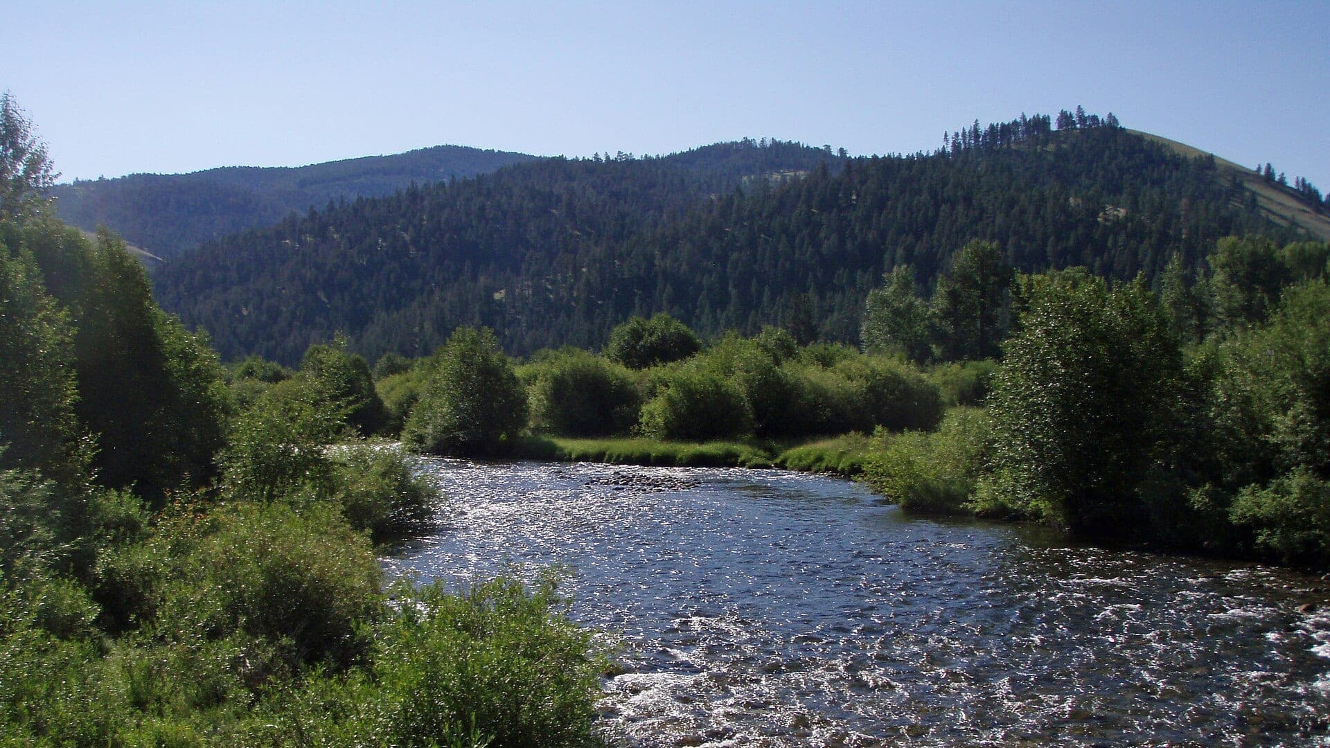
Image: East Fork Bitterroot River / CC BY-SA 3.0 / Mike ClineFishability now: East Fork Bitterroot River fishability today
UnknownData confidence: Medium44/100
Check live sources first because flow has been checked, weather is mild, and no public alert is active.
Flow observed
Not returned
Weather observed
5:00 PM UTC
Score calculated
5:24 PM UTC
Why this rating
Flow
Weather
Public alerts
Next 6-12 hours
Hold
Wait for a better live check before committing the drive or choosing a wading plan.
Flow check
No live chart
Current trend: previous-score comparison will become more useful after repeated live checks.
More planning details: flies, flow bands, and live source checks
Fish it today
Start here
Start with current FWP rules and a public-land access plan near Sula or Conner. Fish a short defined reach carefully instead of trying to solve the entire fork in one day.
Best flow clue
No verified public live gauge is used for this reach. Use the National Weather Service point, recent rain and snowmelt trend, visual clarity, and downstream Bitterroot context before stepping into a narrow or woody reach.
Skip trigger
Skip or move to a larger, better-gauged river when runoff is pushy, roads or public access are unclear, thunderstorms have changed clarity, or water temperature and handling conditions are poor.
Flow decision bands
Clear, stable small freestone
Fish the East Fork when recent weather, visual clarity, and safe pocket-water footing all line up; downstream Bitterroot data is only context.
Runoff or thunderstorm push
High, woody, or quickly rising water should move the plan to larger, better-gauged water or a shorter scout.
Low warm late-day water
Use cool morning windows only and stop when trout handling or active restrictions become the issue.
Road or access limitation
Rough roads, private banks, posted land, or unclear stream-access-law fit can make a fishable creek a poor trip.
Flow check
No live chart
Current trend: previous-score comparison will become more useful after repeated live checks.
No structured live flow
Use the linked flow and access sources before deciding.
Live NWS forecast
70F / Sunny
Water temperature not verified
Heat guidance uses weather and river type unless an official water-temperature value is available.
No NWS alert flag
No active NWS alert was returned for this forecast point.
Do not treat the mainstem Darby gauge as a perfect East Fork reading; it is only downstream context.
Spring runoff can make the East Fork fast, cold, and full of wood or snag hazards.
Small-water trout tactics work best when clarity is good and flows are safe for careful wading.
Check FWP rules and public-land boundaries before fishing near roads or private valley parcels.
Editorial review
How this report is maintained
This East Fork Bitterroot River report is maintained from Montana FWP fishing regulations, current closure and restriction sources, stream-access law, downstream USGS Bitterroot context, Bitterroot National Forest access context, weather, media-credit, and transparent no-exact-gauge planning guidance.
Byline
BlueStreamFly editorial team
Reviewed by
BlueStreamFly source review
Maintained by
Mountain Brook Run LLC
Last material review
2026-06-02
Report confidence
Good confidence
83/100
Good confidence: Montana FWP regulation and restriction sources, stream-access-law context, Bitterroot National Forest context, downstream USGS context, weather data, and route-specific East Fork planning support the page. Confidence is moderated by no exact live reach gauge, private-land complexity, rough access, runoff, and heat restrictions.
Regulations
Montana FWP regulations and current restriction/closure pages support the legal and safety check path.
Access
Stream-access-law and Forest Service context support planning, but exact public entry remains parcel-, road-, and sign-specific.
Flow and weather
Weather and downstream Bitterroot station context help, but no exact public live gauge is verified for the East Fork fishing reach.
Fishing usefulness
The page now separates no-gauge clarity checks, runoff, restrictions, upper-valley road access, small-water tactics, and Bitterroot backup choices.
Fishability dashboard and source review
2026-06-02 / material content or source review
Montana FWP regulations, current restriction and closure sources, stream-access-law context, Bitterroot National Forest access context, downstream USGS Bitterroot station context, National Weather Service point data, and route-specific upper-valley safety sources were checked before updating the current-fishability decision layer.
2026-06-02
Added the current-fishability dashboard with no-exact-gauge decision bands, upper-valley access cards, runoff and restriction backup cues, stable fishability SEO, and confidence signals.
2026-05-28
Added no-exact-gauge trip fit, small-water wade framing, runoff and road-condition skip cues, forest-access nuance, backup-water suggestions, editorial review signals, and a page-specific report-confidence meter after source review.
2026-05-25
Initial source-reviewed report published with no-gauge guidance, weather, hatches, flies, tactics, access, regulations, and FAQs.
Angler planning edge
Local details that change the plan
Best for
Anglers planning a smaller Bitterroot-system freestone day around Sula, Conner, and public forest access, Trips where recent rain, runoff timing, road access, legal public entry, and visual clarity matter more than a live flow number, Light-rod dry-dropper, small streamer, and pocket-water days when the East Fork is clear, cool, and safely wadeable, Anglers comparing the East Fork with the West Fork, main Bitterroot, or Rock Creek before driving into the upper valley
Wade or float
Treat the East Fork Bitterroot as a wade-first small-river plan. Do not use the downstream Darby gauge as a precise safety signal; use it only as drainage context, then confirm road, access, clarity, and safe footing on site.
Best flows
No verified public live gauge is used for this reach. Use the National Weather Service point, recent rain and snowmelt trend, visual clarity, and downstream Bitterroot context before stepping into a narrow or woody reach.
When to skip
Skip or move to a larger, better-gauged river when runoff is pushy, roads or public access are unclear, thunderstorms have changed clarity, or water temperature and handling conditions are poor.
Local plan
Start with current FWP rules and a public-land access plan near Sula or Conner. Fish a short defined reach carefully instead of trying to solve the entire fork in one day.
Pressure
Pressure is usually lighter than the main Bitterroot, but the tradeoff is less exact data and more access homework. Obvious road crossings and forest sites can still concentrate use.
Access nuance
Bitterroot National Forest context helps, but it does not make every valley bank public. Posted land, private parcels, road conditions, and stream-access limits still control the day.
Backup water
If the East Fork is high, woody, muddy, or access-limited, compare the West Fork Bitterroot for better flow support, the main Bitterroot for more room, or Rock Creek for a stronger public-access framework.
About the river
Setting, character, and why it fishes the way it does.
The East Fork Bitterroot River drains the upper Bitterroot country around Sula and Conner before joining the West Fork near the main Bitterroot River. It is smaller and more intimate than the main valley river.
The fishing character is mountain freestone water: pocket water, bends, wood, smaller trout, clear pools, and fast changes after snowmelt or storms.
Because a reliable live reach gauge was not verified, this report is transparent. Anglers should use weather, recent runoff, road access, and visual water checks instead of forcing a misleading graph.
Target species
Cutthroat trout
A key native-trout planning consideration; release carefully under current FWP rules.
Rainbow trout
Possible in connected reaches; check current reach rules before harvest.
Brown trout
More likely in lower, connected, and slightly larger water.
Bull trout
Protected in Montana. Do not target or retain bull trout, and release any incidental fish quickly.
Reading the water
Clear and stable
Fish dry-droppers, small attractors, caddis, and soft hackles through pocket water.
Spring runoff
Expect cold, fast, pushy water and wood hazards; wait for safer flows.
Low summer water
Use longer leaders, smaller flies, shade, and short fights.
After storms
Check clarity and road conditions before dropping into a narrow reach.
Best seasons
Late spring
Fish only between runoff bumps when water is clear and safe.
Summer
The best small-water dry-dropper window, with morning temperature checks.
Early fall
Cooler water, BWOs, and small streamers can help before winter arrives.
Winter
Limited practical access and cold-water opportunity; check rules and roads first.
Flow
East Fork Bitterroot reach conditions
No verified public live gauge was confirmed for the East Fork Bitterroot fishing reach during this review. Use current weather, visual clarity, and the USGS Bitterroot near Darby gauge only as downstream context.
Weather
River weather report
Weather can change wading safety, road access, water temperature, hatches, and the best time of day to fish.
Live forecast loads as you reach this section
This keeps the report fast while still using the official National Weather Service forecast point.
Hatches and flies
Hatch chart and fly picks
April to May
Midges, BWOs, March Browns, early caddis, small stoneflies
BWO emerger, March Brown, soft hackle, small rubberleg, zebra midge
June
Caddis, PMDs, yellow sallies, small golden stones
Elk hair caddis, PMD, yellow sally, pheasant tail, dry-dropper
July to August
Hoppers, ants, beetles, evening caddis, sparse mayflies
Foam hopper, ant, beetle, caddis, small parachute Adams
Fall
BWOs, midges, small streamers, cooling-water brown trout movement
BWO, zebra midge, soft hackle, mini leech, small sculpin
Stoneflies
Pat's rubber legs, Chubby Chernobyl, skwala, golden stone
Use before, during, and after stonefly movement or when trout sit tight to banks.
Mayflies and caddis
BWO, March Brown, PMD, caddis pupa, X-caddis
Use during spring and fall hatches or summer evening riffle feeding.
Terrestrials
Hoppers, ants, beetles, hopper-dropper rigs
Use during summer near grass, shade, undercuts, and slower bank seams.
Streamers
Sculpin, leech, sparkle minnow, small articulated streamer
Use in stained water, cloud cover, fall, or when larger trout hunt edges.
Tactics
How to fish it
Approach from downstream and keep casts short, accurate, and quiet.
Use a small dry-dropper through pocket water before changing flies too often.
Fish shade, undercut banks, soft edges behind boulders, and tailouts.
Carry a few small streamers for stained water, but avoid pushing unsafe runoff.
If a reach is too tight, private, or woody, move instead of forcing it.
Rigging
Rod, leader, and setup notes
A 3-weight or 4-weight is comfortable for most East Fork water.
Use 4X to 6X for small dries and droppers depending on clarity.
Keep rigs simple: one dry, one small dropper, or one small streamer.
Wear stable boots and bring a wading staff for slick pocket water.
Pack water, layers, and bear-aware travel gear for forest-road access.
Access
Access and planning notes
Sula and Conner corridor
Upper-valley condition checkWade / float / trail
Road scout / walk-wade
When to pick it
Start here when roads, weather, clarity, and legal public entry are all straightforward.
Caution
Do not treat downstream Bitterroot flow as a precise East Fork wading signal.
Bitterroot National Forest context
Public-land planningWade / float / trail
Forest road / short wade
When to pick it
Use it when public land, road status, and a short defined reach make the day simple.
Caution
Forest context does not make every valley bank public or every road passable.
FWP restriction and access checks
Rules and safety screenWade / float / trail
Regulation / restriction / access check
When to pick it
Check these before fishing during heat, drought, high runoff, or busy upper-Bitterroot periods.
Caution
Hoot owl, closure, or river-use details can override an otherwise tempting day.
Public access is not continuous. Confirm public land or permission before leaving the road.
Spring water can be fast and snag-filled even when the creek looks small from the bank.
Use nearby mainstem Bitterroot flow only as context, not as an exact East Fork safety signal.
Regulations
Check before fishing
Montana FWP regulations apply, and the East Fork has reach-specific trout rules. Check the current FWP regulations and restrictions before fishing.
Primary base
Sula, Conner, Darby, or Hamilton
Best day style
Forest access, road crossings, small-stream wading, and private-bank awareness
Check first
FWP rules, no-gauge status, recent rain, runoff, road access, and weather
Safety
Fast spring water, wood, private land, rough roads, cold water, and bear-country travel
Gear
Helpful gear for this water
5-weight rod
Covers dries, light nymphs, and most trout presentations.
6-weight rod
Better for wind, stonefly rigs, streamers, and hopper-dropper banks.
Wading staff
Useful in pushy freestone water, tailouts, slick ledges, and roadside access.
Thermometer
Check summer temperatures and stop trout fishing when handling becomes unsafe.
Nearby water
Other water to research
Backup logic
Runoff or muddy water
Compare the West Fork Bitterroot, main Bitterroot, or Rock Creek before forcing small pushy water.
Heat or active restrictions
Fish only legal cool windows or move to colder water with stronger flow support.
Road or storm risk
Shorten the trip and leave the upper valley before weather turns the exit into the problem.
Access doubt
Use confirmed public entry only and pivot rather than guessing at private banks.
West Fork Bitterroot River
A nearby fork with a verified live gauge and dam-influenced planning.
Bitterroot River
The larger valley river when you want more room and better gauge context.
Rock Creek
A different wade-focused Montana creek with strong public planning sources.
FAQ
Fast answers
Is East Fork Bitterroot River fishable today?
East Fork Bitterroot River needs a live-condition check before you commit. The live score is 44/100, based on current flow, weather, public alerts, and the report's planning context. Recheck the linked gauge and forecast before leaving because conditions can change quickly after rain, heat, access changes, or flow swings.
What flow is best for East Fork Bitterroot River?
No verified public live gauge is used for this reach. Use the National Weather Service point, recent rain and snowmelt trend, visual clarity, and downstream Bitterroot context before stepping into a narrow or woody reach.
When should I skip East Fork Bitterroot River?
Skip or move to a larger, better-gauged river when runoff is pushy, roads or public access are unclear, thunderstorms have changed clarity, or water temperature and handling conditions are poor.
Is East Fork Bitterroot River safe to wade right now?
The fishability score is not a wading guarantee. Wade only where your chosen access has safe edges, clear footing, legal entry, and no forced crossings; high, rising, stained, or storm-affected water should be treated conservatively.
What should I check first before fishing the East Fork Bitterroot River?
Check FWP rules, recent rain, snowmelt, road access, weather, and visual water clarity because no exact live gauge was verified.
Are there special regulations on the East Fork Bitterroot River?
Yes. Check the current Montana FWP regulations for the East Fork and nearby Bitterroot reaches.
What flies should I bring for the East Fork Bitterroot River?
Bring the hatch-chart flies, a few confidence nymphs, and a streamer box. Then adjust for water temperature, clarity, and the insects you actually see.
Can I wade the East Fork Bitterroot River?
Yes in public or permitted reaches, but access is mixed and the creek can be woody. Confirm legal access before parking.
When should I skip the East Fork Bitterroot River?
Skip it when flows are unsafe, temperatures stress trout, wildfire or emergency closures are active, or legal access for the reach is not clear.
Sources
Source set for this report
Reviewed 2026-06-02