
Colorado / West
Cache La Poudre River
A practical Poudre report for canyon freestone flows, Fort Collins access, Forest Service corridor planning, and trout-safe seasonal tactics.
Image: Cache La Poudre River as it flows through northern Fort Collins, Colorado / CC BY-SA 3.0 / Decumanus / Matthew TrumpFishability now: Cache La Poudre River fishability today
GoodData confidence: High70/100
Fishable now because the live gauge is rising, weather is usable, and no public alert is active.
Flow observed
5:15 PM UTC
Weather observed
5:00 PM UTC
Score calculated
5:24 PM UTC
Why this rating
Flow
Weather
Public alerts
Next 6-12 hours
Watch
Recheck within the next few hours; rising water or active weather can change clarity and wading quickly.
USGS flow
459 cfs
Current trend: flow rising, rating can drop quickly if clarity or wading safety deteriorates.
More planning details: flies, flow bands, and live source checks
Fish it today
Start here
Choose either upper canyon water or the lower Gateway/Fort Collins section after checking the gauge, instead of trying to split the day across the whole drainage.
Best flow clue
Stable or dropping freestone flow with enough clarity to fish pocket water and enough moderation for safe wading.
Skip trigger
Skip during blown-out runoff, after major summer storm pulses, or when warm low water and heavy recreation use reduce trout-safe options through town.
Flow decision bands
Low but fishable
Low clear water can fish in pockets and banks when temperatures are safe and the target reach still has cover.
Best freestone window
Stable or falling mouth-of-canyon flow with clear water and mild weather is the best dry-dropper signal.
Runoff or storm unsafe
High runoff, dirty summer storm pulses, or pushy canyon water should end crossings and long wades.
Town heat and recreation caution
Lower water near Fort Collins can become a poor trout plan when heat and recreation pressure stack up.
USGS flow
459 cfs
Current trend: flow rising, rating can drop quickly if clarity or wading safety deteriorates.
Live USGS flow
431 cfs / rising about 71%
Live NWS forecast
78F / Partly Sunny
Water temperature not verified
Heat guidance uses weather and river type unless an official water-temperature value is available.
No NWS alert flag
No active NWS alert was returned for this forecast point.
Use RiverReports for a quick chart and USGS 06752260 for the official mouth-of-canyon trend before deciding between upper canyon and town water.
The Forest Service notes that the Poudre is Colorado's only nationally designated Wild and Scenic River, but that scenic appeal also means runoff, rafters, and roadside pressure matter.
Colorado lists several special-regulation sections on this drainage, including the Gateway Park to North Fork confluence stretch as artificial flies and lures only with immediate trout release.
Skip the trip when the river is blown out, when afternoon thunderstorms threaten the canyon, or when town recreation traffic makes the Fort Collins reach more of a safety problem than a fishing plan.
Editorial review
How this report is maintained
This report uses official regulation, flow, weather, access, and public-land sources first, then adds practical planning guidance for fly anglers.
Byline
BlueStreamFly editorial desk
Reviewed by
BlueStreamFly source review
Maintained by
BlueStreamFly
Last material review
2026-05-31
Report confidence
Good confidence
88/100
Good confidence: RiverReports, USGS mouth-of-canyon flow, Forest Service corridor information, Gateway Natural Area, Poudre River Whitewater Park, Colorado special-regulation sources, and weather data support the page. Confidence is moderated by broad canyon-to-town scope, runoff, recreation pressure, warm lower water, and access variation.
Regulations
Colorado special-regulation sources support the legal-check path for Poudre trout water.
Access
Forest Service corridor, Gateway Natural Area, and Fort Collins park sources support public access planning, with exact pullouts and private edges still requiring care.
Flow and weather
RiverReports, USGS 06752260, and the National Weather Service point are attached to the route.
Fishing usefulness
The page now separates canyon, Gateway, and town plans, runoff timing, storm color, recreation pressure, heat, and backup choices.
Fishability dashboard and source review
2026-05-31 / material content or source review
RiverReports, USGS Cache La Poudre River at mouth of canyon flow data, Forest Service Cache La Poudre corridor information, Gateway Natural Area and Poudre River Whitewater Park access sources, Colorado special-regulation sources, and the National Weather Service point were checked before updating the current fishability guidance.
2026-05-31
Updated Cache La Poudre River with mouth-of-canyon trend guidance, canyon and town access cards, runoff and recreation cautions, backup cues, stable fishability SEO, and confidence signals.
2026-05-29
Added a page-specific report-confidence meter for Cache La Poudre flow, canyon and Fort Collins access, regulation checks, weather, runoff safety, and pressure-aware trip planning.
2026-05-25
Published a new Cache La Poudre report with flow support, access planning, regulation notes, and practical canyon-versus-town guidance.
Angler planning edge
Local details that change the plan
Best for
Freestone dry-dropper days, Fort Collins short sessions, Front Range runoff-timing decisions
Wade or float
Wade first. This page is built around bank access, walk-in stretches, and short canyon entries rather than boat planning.
Best flows
Stable or dropping freestone flow with enough clarity to fish pocket water and enough moderation for safe wading.
When to skip
Skip during blown-out runoff, after major summer storm pulses, or when warm low water and heavy recreation use reduce trout-safe options through town.
Local plan
Choose either upper canyon water or the lower Gateway/Fort Collins section after checking the gauge, instead of trying to split the day across the whole drainage.
Pressure
Pressure rises fast near campgrounds, obvious pullouts, Gateway, and Fort Collins access parks. Early starts and slightly longer walks help.
Access nuance
Public access exists, but the best fishing often comes from smaller decisions about parking, water color, and how much wading room the day actually gives you.
Backup water
Shift to Big Laramie, Boulder Creek, or Clear Creek if the Poudre is still too high or warm.
About the river
Setting, character, and why it fishes the way it does.
The Cache La Poudre starts high on the Front Range and drops hard through a long canyon before flattening through Laporte and Fort Collins. That change in gradient creates very different fishing, access, and water temperatures within the same day drive.
The Forest Service corridor west of town is the classic freestone plan with campgrounds, pullouts, and short pocket-water sessions. The lower river near Gateway and Fort Collins is better for shorter access, mixed seams, and more cautious warm-season temperature checks.
This is a river where runoff timing matters. When the gauge is still climbing or carrying color, the best decision is often to wait, fish a different elevation band, or choose another Front Range report entirely.
Target species
Brown trout
Common through the canyon and lower public reaches.
Rainbow trout
Present in popular public sections, especially where cooler current and habitat improvements hold fish.
Cutthroat trout
Possible in colder upper reaches and tributary influence water; handle carefully.
Whitefish
Common enough to keep nymph anglers honest and to signal deeper holding seams.
Reading the water
High runoff
Fish only soft edges and side seams, or wait for safer visibility and depth.
Moderate clear flow
Best all-around condition for covering pocket water with dry-dropper rigs.
Low late-summer flow
Start early, fish shade and oxygenated runs, and monitor temperature closely through town.
Town reach
Expect more recreation use and softer currents than the upper canyon, with access often easier than wading.
Best seasons
Late spring
Good only around the edges of runoff when clarity and safe wading return.
Summer
Primary freestone season for dry-dropper, caddis, and terrestrial fishing.
Early fall
Usually the most balanced mix of stable flow, cool nights, and lower crowd pressure.
Winter
Fishable in select lower sections on mild days, but expect slower nymphing and icy access.
Preferred flow source
Cache La Poudre River
RiverReports is the preferred chart source when coverage exists. When a matching USGS gauge exists, keep it open as the official backstop for station data and current hydrograph context.
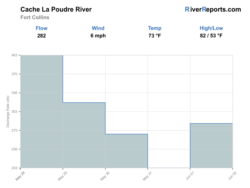
USGS data chart
Official USGS trend
Streamflow over the latest USGS reporting window.
Latest
434 cfs
Jun 3, 4 PM UTC
Weather
River weather report
Weather can change wading safety, road access, water temperature, hatches, and the best time of day to fish.
Live forecast loads as you reach this section
This keeps the report fast while still using the official National Weather Service forecast point.
Hatches and flies
Hatch chart and fly picks
Spring
Midges, BWOs, little black stones, and early caddis
RS2, zebra midge, black stone nymph, caddis pupa
Summer
Caddis, PMDs, yellow sallies, hoppers, ants, and beetles
Elk hair caddis, PMD nymph, stimulator, foam hopper
Late summer
Terrestrials and evening caddis
Ant, beetle, hopper-dropper, X-caddis
Fall
BWOs, midges, and small streamer windows
RS2, midge larva, pheasant tail, olive bugger
Canyon search flies
Stimulator, chubby, perdigon, stonefly nymph, hare's ear
Main setup for fast upper-river pocket water.
Fort Collins reach flies
Soft hackle, caddis pupa, zebra midge, small streamer
Useful around softer seams and habitat-improved town water.
Late-summer bugs
Foam ant, hopper, beetle, BWO parachute
Best when flows are lower and fish are looking up.
Tactics
How to fish it
Cover short pockets quickly in the canyon and save long drifts for the gentler lower river.
When runoff is falling, focus on inside seams, boulders near shore, and current breaks created by woody edges.
On summer mornings, dry-dropper rigs catch the most water fast; by midday, smaller nymphs and shade lines often matter more.
In Fort Collins, fish early to beat recreation traffic and shift to less obvious seams instead of crowding the most visible access points.
Rigging
Rod, leader, and setup notes
A 4- or 5-weight with floating line covers nearly every trout setup on the Poudre.
Carry both dry-dropper and indicator nymph materials because the upper and lower river fish differently.
Use stronger tippet in turbulent canyon pockets and finer leaders when late-summer flows shrink.
A wading staff helps on round cobble and slippery channel shelves near town access points.
Access
Access and planning notes
Upper and middle canyon
Freestone trout planWade / float / trail
Forest road / wade / bank
When to pick it
Use it when flow is falling and Forest Service access is open.
Caution
Canyon pullouts, private edges, and high water require current checks.
Gateway Natural Area
Defined public accessWade / float / trail
Natural area / walk / wade
When to pick it
Pick it when conditions support a shorter lower-canyon session.
Caution
Access hours, crowding, and warm lower water can limit the day.
Fort Collins / Whitewater Park reach
Lower-river scout or backupWade / float / trail
Park / bank / urban scout
When to pick it
Use it when you are intentionally checking lower public water.
Caution
Recreation, warm water, and urban access may not match a trout-first plan.
The Forest Service river corridor includes many recreation sites, but campsite activity, rafters, and roadside pressure change the feel of each reach.
Gateway Natural Area and Fort Collins parks improve access, but easy parking also concentrates pressure and summer non-fishing traffic.
Use town reaches as short early or shoulder-season sessions; use the canyon when you want a more classic freestone day and the flow agrees.
Regulations
Check before fishing
Colorado's special-regulation page lists multiple Poudre sections with artificial-flies-and-lures-only and immediate-release rules, including the Gateway Park stretch down to the North Fork confluence. Read the statewide special-regulation page before changing reaches.
Primary base
Fort Collins for mixed access or Poudre Canyon camp/town stops for upper river focus
Best day style
One canyon section or one lower-river section, not both
Check first
RiverReports, USGS 06752260, thunderstorm risk, and section-specific regulations
Safety
Runoff push, canyon traffic, slick boulders, and recreation traffic near town
Gear
Helpful gear for this water
4- or 5-weight rod
Good balance for canyon wind, dry-dropper rigs, and town seams.
Wading staff
Useful whenever runoff leaves boulders polished and current pushy.
Thermometer
Important through Fort Collins in low late-summer water.
Dry bag or rain shell
Thunderstorms and splashy bank moves are common in the canyon.
Nearby water
Other water to research
Backup logic
High water
Compare Big Laramie, Boulder Creek, or Clear Creek after checking current flow and weather.
Heat
Move higher, fish early, or stop trout pressure in warm lower water.
Storms or stain
Wait for summer storm color and debris to clear before fishing canyon pockets.
Access issue
Use Forest Service or city-listed access only; pick another route if parking or bank legality is unclear.
Big Laramie River
A good high-country alternative when you want cooler water and a different crowd pattern.
Boulder Creek
Useful backup for a shorter Front Range trout session.
Clear Creek
Another lower-elevation option when runoff timing is better farther south.
FAQ
Fast answers
Is Cache La Poudre River fishable today?
Cache La Poudre River looks fishable right now. The live score is 70/100, based on current flow, weather, public alerts, and the report's planning context. Recheck the linked gauge and forecast before leaving because conditions can change quickly after rain, heat, access changes, or flow swings.
What flow is best for Cache La Poudre River?
Stable or dropping freestone flow with enough clarity to fish pocket water and enough moderation for safe wading.
When should I skip Cache La Poudre River?
Skip during blown-out runoff, after major summer storm pulses, or when warm low water and heavy recreation use reduce trout-safe options through town.
Is Cache La Poudre River safe to wade right now?
The fishability score is not a wading guarantee. Wade only where your chosen access has safe edges, clear footing, legal entry, and no forced crossings; high, rising, stained, or storm-affected water should be treated conservatively.
Which Poudre reach is best for fly fishing?
It depends on flow. Higher canyon water is the classic freestone plan, while Gateway and Fort Collins make more sense for shorter-access sessions once temperatures and recreation traffic line up.
Can I trust the town reach when the canyon is high?
Sometimes, but not automatically. Use the gauge and visibility first, because high canyon water usually means pushier lower-river current too.
What regulation check matters most here?
Read the Colorado special-regulation page for the exact stretch you want to fish, especially around Gateway and other named Poudre sections.
Sources
Source set for this report
Reviewed 2026-05-31